


Location:
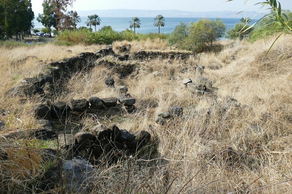
Tel Hadar (Sheikh Khadhr) is situated on the eastern shore of the Sea of Galilee, approximately 7 km north of ‘En Gev. The mound is rounded, covering an area of about 2.5 acres.
Excavations:
The site was first discovered and surveyed in the 1968 Golan Survey. Excavations began in 1987 as part of the Land of Geshur Project of the Institute of Archaeology at Tel Aviv University. The excavations were directed by M. Kochavi and P. Beck, with support from Cornell University and the Archaeological Consortium of New Jersey Colleges.
Stratum II (Eleventh Century BCE):
- Two concentric stone walls defined the mound’s surface. The outer wall was 4 meters thick, while the inner wall was 2.5 meters thick.
- A gate on the eastern side of the mound was discovered, with nearby findings including a large basalt basin, basalt tripod bowls, and two orthostats.
- A public building was found near the gate, consisting of a pillared building and a granary. The pillared building is one of the earliest examples of this architectural type.
- The granary was unique, with thick stone walls and divided into six square, paved cells. Each cell had a passage to the adjoining cell. The granary was destroyed by a massive fire in the eleventh century BCE.
Stratum I (Iron Age II):
- This stratum saw the development of an ordinary settlement on the ruins of Stratum II. The outer wall of Stratum II was reused.
- The settlement consisted of private houses built closely together, with many shared walls. The houses had broad or square rooms without pillars.
Pottery and Artifacts:
The site yielded a variety of pottery, including egg-shaped jars, three-handled jars, and imported ware from the Phoenician coast. Other findings included bichrome flasks and jugs, bowls with incised rims, and charred grains of wheat.
Biblical Hiking map