

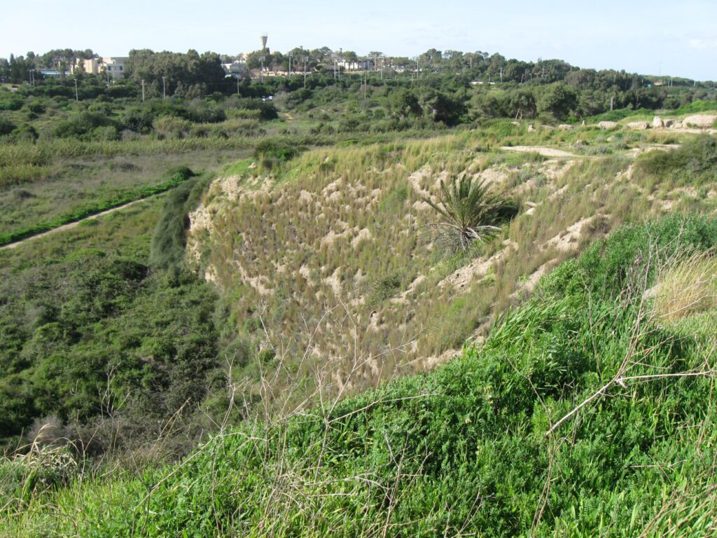
Location
Tel Poleg is located approximately 6 km south of Netanya and 1.2 km inland from the Mediterranean Sea, situated on a kurkar spur.
History
The site experienced significant occupation during the Middle Bronze Age IIA, the Iron Age, and the Persian period. Its history is marked by periods of settlement influenced by the surrounding swampy terrain.
Excavations
Salvage excavations at Tel Poleg were conducted in 1959 by R. Gophna, P. Beck, and J. Naveh, with a reexamination in 1964 after the site was largely destroyed by quarrying.
Findings at Tel Poleg
Middle Bronze Age IIA:
Fortifications: The site featured well-fortified structures, likely part of a fortress. This included a 2.7 m thick brick wall built on the steep declivity of the kurkar ridge and a large brick tower (about 8.5 m thick) in the southwest. The tower and western wall were built on slightly sloping ground and reinforced by a rampart of kurkar gravel.
Gate Structure: In the northwestern part, the right side of a gate, probably of the indirect-access type, was found.
Burial Cave: A shaft of a burial cave from this period was discovered, though it had been destroyed by quarrying and its contents robbed.
Pottery: All Middle Bronze Age II pottery excavated at Tel Poleg was assigned to this period, indicating a significant settlement phase.
Iron Age IIA:
Settlement: An unfortified settlement covered most of the site, with remains almost totally destroyed by quarrying. Rubbish pits filled with ash and sherds from this period were found.
Pottery: The sherds from the Iron Age IIA suggest a settlement dating to the second half of the 10th century BCE. Similar pottery has been found at other sites in the Coastal Plain and Jezreel Valley.
Sources
Stern, Ephraim-New Encyclopedia of Archaeological Excavations in the Holy Land 4-Israel Exploration Society (1993)
Biblical Hiking map