

Location
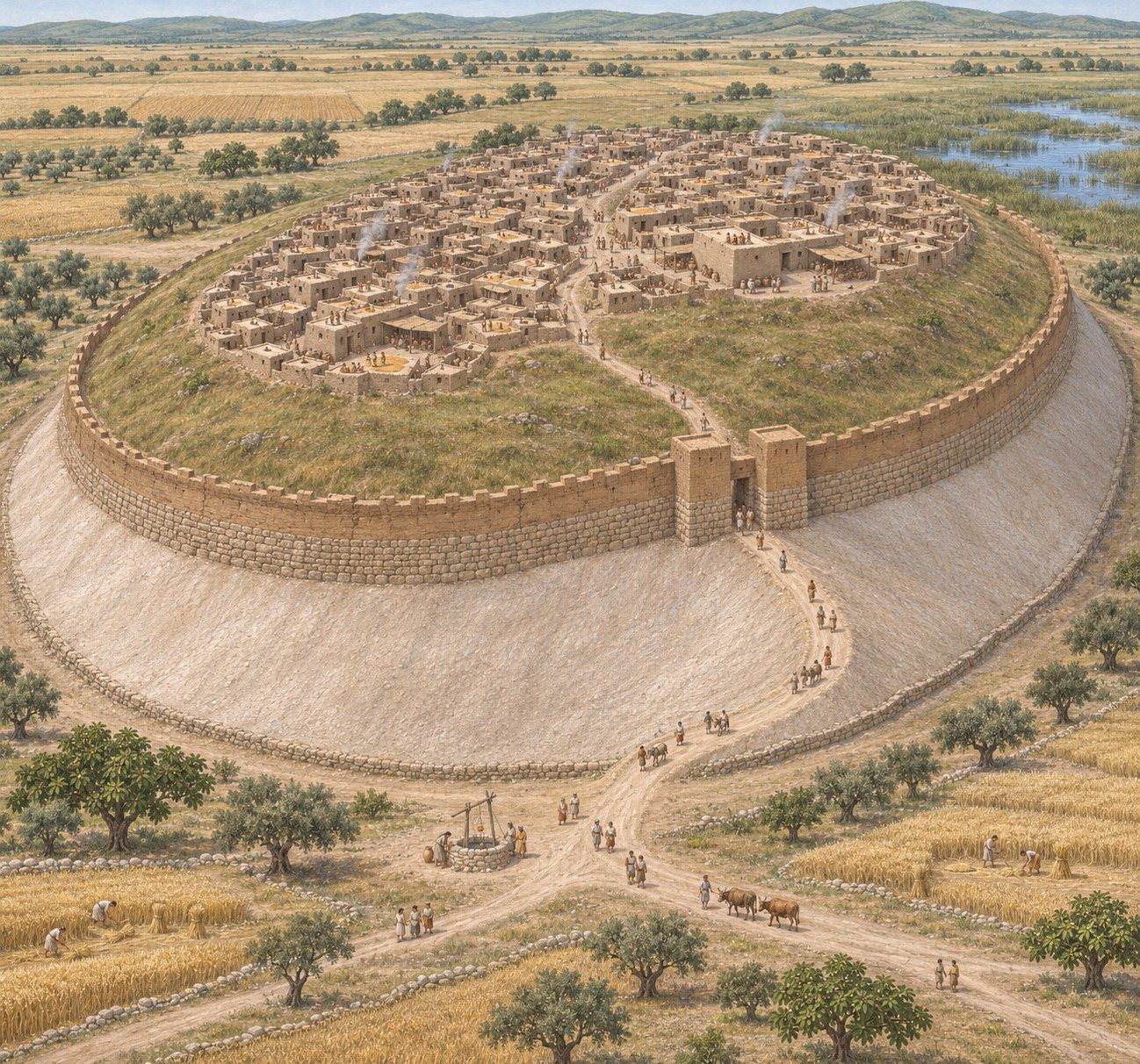
Tel Keisan (Hebrew Tel Kisson) lies in the center of the northern basin of the Akko coastal plain, about 8 km from the sea, between Haifa and Akko. The mound rises about 25 m above the plain, is oval in shape and covers about 6 hectares. Although it is not on the coast, it was connected to the maritime world through the port of Akko, and at times it apparently served as an important granary for the city.

Identification
The ancient name of the mound is not known for certain. The main proposal identifies it with Achshaph, a Canaanite city mentioned in Egyptian texts and in the Bible, though some locate Achshaph elsewhere. Cabul and Mishal, towns of Asher, have also been proposed.
History
Bronze Age. In the Early and Middle Bronze Ages the mound held a large, prosperous settlement. In the Middle Bronze Age it was fortified with a wall and a stone-faced rampart (glacis). In the Late Bronze Age the settlement shrank considerably, and a destruction layer from the early 12th century BCE is evident.
Iron Age. In the second half of the 11th century BCE the settlement was rebuilt. It has been suggested that in the Iron Age the site was an enclave of Phoenician Tyre, perhaps connected to the biblical “land of Cabul.” In the 8th century BCE the settlement was destroyed and abandoned, and in the 7th century BCE it was resettled under Assyrian rule. Evidence of Assyrian culture from this period includes a cuneiform tablet. The settlement was destroyed again at the end of the 7th century.
Persian and Hellenistic periods. Settlement resumed in the Persian period and continued into the Hellenistic period, until the site was abandoned in the 2nd century BCE. According to Strabo and Diodorus, the Persians massed large armies in the Plain of Akko for their campaigns against Egypt. In December 2018 the excavators uncovered remains of a Persian military outpost that may have played a role in Cambyses II’s invasion of Egypt in 525 BCE. The Persian-period fortifications were damaged during Alexander the Great’s conquest in the 4th century BCE.
Byzantine period and Middle Ages. In the Byzantine period a small settlement existed on the mound around a 6th-century CE church, which remained in use until the 7th century. During the Third Crusade, at the siege of Acre (1189–1191), the mound served as a camp and headquarters for Saladin.
Biblical Context
If the mound is Achshaph, it is mentioned among the Canaanite cities whose kings joined Jabin king of Hazor against Joshua (Joshua 11:1), in the list of defeated kings (Joshua 12:20), and among the towns of Asher (Joshua 19:25). If it is Cabul, it is connected with the story of the twenty towns Solomon gave to Hiram king of Tyre (1 Kings 9:10–13). The archaeological evidence for a strong Phoenician presence on the mound in the Iron Age fits the biblical picture of a region that remained within Tyre’s sphere of influence.
History of Research
In the 19th century the mound was surveyed by the Palestine Exploration Fund. In 1935–1936 a British expedition headed by John Garstang and Alan Rowe excavated there; the work was cut short by the unrest of 1936, and some of the finds were damaged during World War II. In 1971–1980 the École Biblique et Archéologique Française in Jerusalem excavated the mound, with Roland de Vaux, Jean Prignaud, Jacques Briend and Jean-Baptiste Humbert. Since 2016 an international expedition headed by David Schloen (University of Chicago), Gunnar Lehmann (Ben-Gurion University of the Negev) and Bernd Schipper (Humboldt University of Berlin) has been excavating the site, with seasons in 2016, 2018, 2019, 2022 and 2023 (Tell Keisan Excavations).
Main Finds
The silver hoard. The hoard was found in the courtyard of a domestic complex, inside a Phoenician Bichrome jug. It contains cut ingots, sheet silver, wires, rods, jewelry and four cloth-wrapped bundles sealed with unbaked clay bullae, weighing about 345 g in total. It is one of the earliest hacksilber hoards in the region, and its silver has a high copper content, apparently added deliberately.
The cuneiform tablet. A fragment of an Assyrian tablet with a ration list, found in the 1979–1980 excavations. It attests to the presence of the Assyrian administration at the site in the 7th century BCE.
Fortifications and buildings. Middle Bronze Age II fortifications; Iron Age buildings constructed on terraces down the slope, perhaps covering the Middle Bronze Age city gate; and Iron Age II enclosures and courtyards indicating the agricultural character of the settlement.
The Byzantine church. A 6th-century CE church and a cross carved in the rock.
References
Briend, J., & Humbert, J.-B. (1980). Tell Keisan (1971–1976): une cité phénicienne en Galilée. Fribourg: Éditions Universitaires; Göttingen: Vandenhoeck & Ruprecht; Paris: Gabalda.
Humbert, J.-B. (1993). Keisan, Tell. In E. Stern (Ed.), The New Encyclopedia of Archaeological Excavations in the Holy Land, vol. 3. Jerusalem: Israel Exploration Society & Carta.
Zilberg, P. (2015). A new edition of the Tel Keisan cuneiform tablet. Israel Exploration Journal 65.
Eshel, T., et al. (2018). Four Iron Age silver hoards from southern Phoenicia. Bulletin of the American Schools of Oriental Research 379.
Lehmann, G., & Neumeier-Potashnik, A. (2024). Under imperial rule: Tell Keisan during the late 8th and 7th centuries BCE. Die Welt des Orients.
Biblical Hiking map
See Tel Keisan on the mapMore than 400 sites of the biblical period, by period and layerOpen the mapFound an error or missing information in this entry? Let us know.