Identification and History:
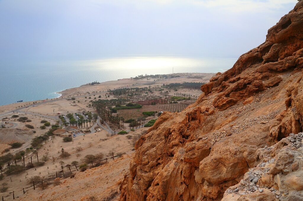
En-Gedi is an oasis on the western shore of the Dead Sea and stands as one of the most significant archaeological sites in the Judean Desert. The name En-Gedi is associated with the perennial spring flowing from a height of 200 m above the Dead Sea. The area around the spring is referred to as the “wilderness of En-Gedi” in biblical narratives, particularly in stories about David’s interactions with Saul. The site is also mentioned in the Song of Songs, in connection with its vineyards, and in a prophecy by Ezekiel.

Biblical References:
En-Gedi is prominently mentioned in biblical narratives. In the stories about David’s flight from Saul, the desert area near the spring is referred to as the “wilderness of En-Gedi” (1 Sam. 24:1). The walled camps atop the mountains are described as the “strongholds of En-Gedi” (1 Sam. 23:29). Additionally, En-Gedi is listed among the cities of Judah in the wilderness (Jos. 15:62). In a later biblical source, it’s somewhat arbitrarily identified with Hazazon-Tamar (2 Chr. 20:2). The site is also mentioned in the Song of Songs (1:14) in connection with its vineyards and in a prophecy by Ezekiel (47:10).
Second Temple and Later Periods:
Various references from the Second Temple, Roman, and Byzantine periods highlight En-Gedi’s significance. Josephus lists En-Gedi among the headquarters of Judea’s toparchies and notes that the Sicarii raided it during the First Revolt against Rome. Pliny mentions its destruction during the same war. Documents from the Cave of the Letters in Nahal Hever indicate that En-Gedi was a Jewish village that became the property of the emperor, with a Roman garrison stationed there. During the Bar-Kokhba Revolt, En-Gedi served as one of Bar-Kokhba’s administrative and military centers. Church fathers from the Roman-Byzantine period describe En-Gedi as a large Jewish village.
Agriculture and Economy:
En-Gedi was renowned for its excellent dates and crops of balsam-producing plants. The combination of a tropical climate and an abundant water supply allowed the inhabitants to cultivate these plants, especially balsam, for which En-Gedi became famous.
Tel Goren (Tell el-Jurn):
Located southwest of the plain near Nahal ‘Arugot, this site was the primary center of settlement in the oasis from the end of the Iron Age onwards. The settlers built on the hill’s terraces and expanded into the plain between Nahal David and Nahal ‘Arugot over time.
Iron age:
Occupation Levels:
At Tel Goren, five distinct occupation levels can be identified. Specifically, for the Iron Age, Stratum V represents the end of the Iron Age, approximately from 630-582 BCE.
Architectural Remains:
A plan of an Iron Age house from Stratum V was identified. This suggests that during the Iron Age, there were established structures and possibly a thriving community.
Artifacts:
A fragment of a pottery vessel decorated with reliefs from the Iron Age was discovered. Such artifacts provide insights into the artistic and cultural practices of the inhabitants during this period.
Excavations:
Initial Surveys:
En-Gedi was first surveyed in 1949 by B. Mazar, A. Reifenberg, and T. Dothan. These surveys revealed the defensive network of the oasis, water-supply systems, and remains from the Chalcolithic period.
1960s and 1970s Excavations:
Between 1961-1965, excavations were conducted mainly on Tel Goren by B. Mazar, I. Dunayevsky, T. Dothan, and E. Stern. From 1970 to 1972, D. Barag and Y. Porath excavated the synagogue at En-Gedi.
1996s and 2002s Excavations:
Excavations were conducted under the direction of Y. Hirschfeld on behalf of the Institute of Archaeology of the Hebrew University of Jerusalem. These excavations focused on several areas in the En-Gedi oasis, including the Roman-Byzantine village, the Roman bathhouse, Meẓad ‘Arugot, the flour mills, and the Essene site. Additionally, the agricultural terraces and irrigation system were studied.
Sources
Stern, Ephraim-New Encyclopedia of Archaeological Excavations in the Holy Land 1-Israel Exploration Society (1993)


