


Location and Identification:
‘En Gev is situated on the narrow plain on the eastern shore of the Sea of Galilee. The site, approximately 250m long and 120m wide, rises only a few meters above the plain. It’s evident that its inhabitants chose to build their settlement on the shore rather than on a hill for natural protection. The site is adjacent to the road that ran from Beth-Shean to the fords of the Jordan and then followed the eastern shore of the Sea of Galilee up to the vicinity of ‘En Gev. From there, the road ascended the Golan Heights to Hippos and Aphek (Fiq) and continued north to Damascus.
Identification with Aphek:
The strong fortifications and public buildings on the site suggest an identification with Aphek, which was an advanced Syrian (Aramean) outpost in the ninth and eighth centuries BCE. This identification, originally proposed by M. Dothan, is supported by survey results at Afiq/Fiq. While the name is preserved at Afiq/Fiq, no Iron Age sherds were found there. The excavations at Tel Soreg, closer to Afiq, revealed evidence of only a small wayside fort from the Iron Age II; this fort was only 20 by 20m in size and could hardly be identified as the great fortified city from which Ben-hadad went to war and to which he retreated after his defeat by Ahab.
Exploration and Excavations:
Initial exploratory soundings were conducted in 1961 by an expedition representing the Israel Department of Antiquities and Museums and the Hebrew University of Jerusalem. The team included B. Mazar, A. Biran, I. Dunayevsky, and M. Dothan. Excavations at ‘En Gev resumed in 1990.
Excavations at ‘En Gev resumed in 1990-1991 by a Japanese expedition, under the auspices of the Land of Geshur Project of the Institute of Archaeology at Tel Aviv University. The excavations were directed by H. Kanaseki of Tenri University and H. Ogawa of Keio University. The new excavations took place at the northeastern corner of the citadel, some 70 m east of the previous expedition’s areas.
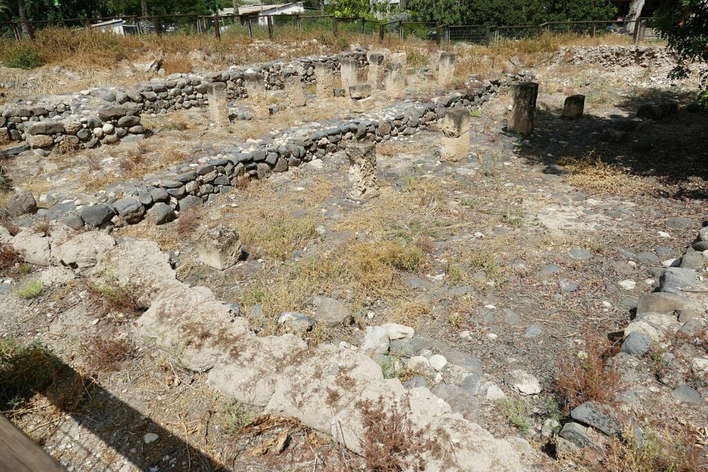
Findings:
- Strata 5-4: The earliest city (stratum 5) had a foundation for a brick wall. This wall was later replaced by a casemate line (stratum 4) with two walls built of large, undressed stones. The casemate wall is similar to those found at Megiddo and Hazor from Solomon’s reign. Few building remains were uncovered in these strata, but potsherds from the tenth century BCE were found.
- Strata 3-2: After the destruction of the earlier city, a new town (stratum 3) was built on its ruins. The new wall in stratum 3 was buttressed on the outside. The wall consisted of alternating narrow and broad sections. An orthostat with carvings and a stone incense spoon were found from stratum 3. A storage jar with the inscription “(belonging) to Sqy'” was discovered from stratum 2.
Biblical Hiking map