

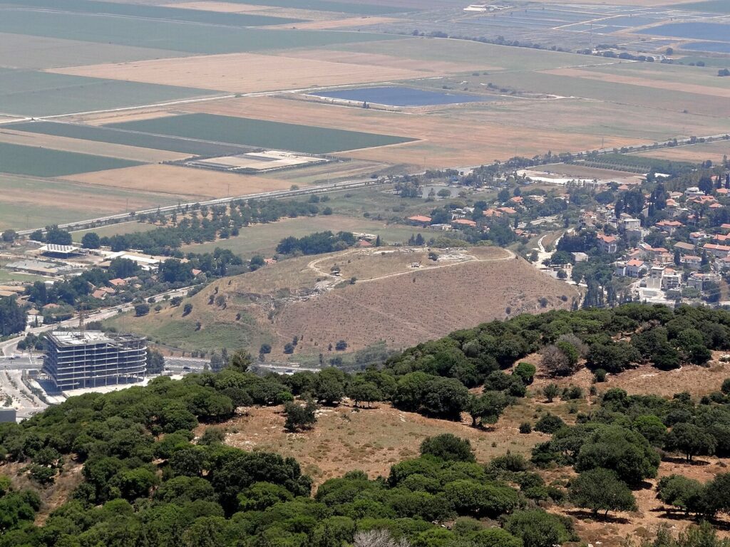
Location and Identification
Jokneam, also known as Tel Yoqne’am, is a large mound located at the junction of Mount Carmel and the Jezreel Valley. Positioned near major routes across the Carmel Range and the Coastal Plain, it was one of three major cities in the western Jezreel Valley, alongside Shimron and Megiddo.
History
Jokneam has a rich history of continuous habitation from the Early Bronze Age to the Mameluke period, spanning nearly four thousand years. It was a key center during the Arab and Crusader periods and was mentioned in historical texts dating back to Thutmose III’s campaign in the 15th century BCE.
Biblical Context
In the Bible, Jokneam is mentioned in the book of Joshua, including as a Levitical city within the territory of the tribe of Zebulun. It’s associated with various historical names in different periods, such as Kammuna and Caymont.
Excavations
Excavations at Jokneam were conducted from 1977 to 1988, led by A. Ben-Tor on behalf of the Hebrew University of Jerusalem. The excavations focused on five test trenches (A to E), with areas A and B in the northwest later combined to form a single area.
Findings
- Strata I to XV: Twenty-seven occupation levels have been identified, spanning from the Ottoman period to the Iron Age.
- Iron Age III-II (Strata XI-XV): Fragmentary remains of structures and installations, including a double city wall and a peripheral street in the Iron Age II.
- Persian Period (Strata VIII-X): Local and imported ware, unfortified settlement on terraces.
- Hellenistic Period (Stratum VII): A small square tower and several wall lengths.
- Byzantine and Roman Periods (Strata V-VI): Few pottery sherds recovered.
- Early Arab Period (Stratum IV): Prosperous settlement with well-planned buildings, dated between the end of the 8th century and the mid-10th century CE.
- Crusader Period (Stratum III): A church with an unusual plan and a stonewall surrounding the entire mound.
- Mameluke Period (Stratum II): Two building phases near the church, dated to the 14th century CE.
- Ottoman Period (Stratum I): Represented only by several pottery sherds.
Sources
Stern, Ephraim-New Encyclopedia of Archaeological Excavations in the Holy Land 2-Israel Exploration Society (1993)
Biblical Hiking map